..WIDESPREAD AND SIGNIFICANT AMOUNTS OF SNOW AND SLEET POSSIBLE FOR VERMONT AND NORTHERN NEW YORK THURSDAY NIGHT INTO FRIDAY NIGHT...
LOW PRESSURE WILL DEVELOP ACROSS THE SOUTHERN PLAINS STATES WEDNESDAY NIGHT...AND PUSH NORTHEAST INTO THE WESTERN GREAT LAKES BY FRIDAY MORNING. AS THIS OCCURS...ADDITIONAL LOW PRESSURE WILL DEVELOP ALONG THE NORTHERN MID ATLANTIC COAST DURING FRIDAY...AND MOVE NORTHEAST INTO THE GULF OF MAINE FRIDAY NIGHT. THE COMBINATION OF THESE TWO FEATURES WILL ALLOW WIDESPREAD SNOW TO OVERSPREAD NORTHERN NEW YORK AND VERMONT THURSDAY NIGHT...AND CONTINUE DURING THE DAY ON FRIDAY BEFORE TAPERING OFF FRIDAY NIGHT. ADDITIONALLY...INDICATIONS ARE THAT WARMER AIR ALOFT MAY PUSH INTO THE REGION FROM THE SOUTH AND WEST ON FRIDAY. IF THIS OCCURS...THE POSSIBILITY EXISTS THAT SIGNIFICANT AMOUNTS OF SLEET MAY MIX IN WITH THE SNOW DURING THE LATE MORNING INTO THE AFTERNOON HOURS. AT THIS TIME...AREAS ACROSS NORTHERN NEW YORK AND CENTRAL AND SOUTHERN VERMONT APPEAR TO HAVE THE HIGHEST LIKELIHOOD OF EXPERIENCING A PROLONGED PERIOD OF SLEET. THE PRECIPITATION IS EXPECTED TO TAPER OFF TO SNOW SHOWERS BY FRIDAY NIGHT ACROSS THE AREA.
AT THIS TIME...CONFIDENCE IS INCREASING THAT SIGNIFICANT AMOUNTS OF SNOW AND SLEET WILL OCCUR ACROSS MOST OF THE NORTH COUNTRY LATER THURSDAY NIGHT INTO FRIDAY. THE BEST COURSE OF ACTION FOR A WINTER STORM IS PREPAREDNESS. PERSONS ACROSS NORTHERN NEW YORK AND VERMONT SHOULD TAKE THE NECESSARY ACTIONS TO PREPARE FOR THIS UPCOMING WEATHER EVENT.
Tuesday, February 27, 2007


Stolen Snowmobiles
(2) Snowmobiles stolen Tyson area of Plymouth VT. Garage broken into sometime between 2/19 and 2/22.
1)1999 Yamaha Phazer , White with Yellow skis, SN 8DJ006894. Vt. Reg. 74MG, Woodford club pass.
2) 1997 Skidoo formula , Red 380 CC Fan, SN 1100802832, Vt. Reg. 73MG, Woodford club pass.
Please contact Skip 860-559-0492
1)1999 Yamaha Phazer , White with Yellow skis, SN 8DJ006894. Vt. Reg. 74MG, Woodford club pass.
2) 1997 Skidoo formula , Red 380 CC Fan, SN 1100802832, Vt. Reg. 73MG, Woodford club pass.
Please contact Skip 860-559-0492
Friday, February 23, 2007
February 2007 Newsletter
February 2007 Newsletter
President: Art Dages(496-2577)
Trail Master: Marty DeHeer(496-7051)
Vice President: Tony Amenta
Asst. Trail Master: Paul Pizzale
Secretary: Cathi Dages
Safety Instructor: Skip Wallace
Treasurer: Lois DeHeer
We had our February meeting at the Fayston Town Hall on Tuesday, February 6, 2007. Twelve members attended. Please join us at the next meeting.
PROGRESSIVE DINNER: FEBRUARY 24, 2007
Our progressive dinner will take place regardless of snow conditions. There is a limit of 30 people for this event. Please RSVP by February 16th to Art or Cathi Dages at 496-2577. A donation of $5 per person is requested. Appetizers will be served at 6:00 pm at Reggie and Kathi Orr’s. If you wish to have a tour guide, meet at Kenyon’s at 5:30 pm. If anyone would like to help with appetizers or desserts please call Kathi Orr at 407-4161 for appetizers and Cathi Dages at 496-2577 for desserts.
CANADA RIDE
Our club trip to Real Masse will be March 2, 2007. We will be leaving from Kenyon’s at 9:00am. There is a limit of 20 members for this ride. Spaces are already beginning to fill. Call Art Dages at 496-2577 as soon as possible to reserve a spot.
VAST SCHOLARSHIPS
There are two $1500 scholarships available from VAST for members, spouses, or dependents. Contact Art Dages (496-2577) for further information. Applications must be in the VAST office by March 1st.
MRRR BLOG SITE
Don’t forget to check our Blog site for the latest information. Tony has been updating regularly. The address is: MADRIVERRIDGERUNNERS.BLOGSPOT.COM
NEXT MEETING will be Tuesday, March 13, 2007 at 7:00 pm at the Fayston Municipal Building. (NOTE: this is a change to the second Tuesday of the month – due to Town Meeting
President: Art Dages(496-2577)
Trail Master: Marty DeHeer(496-7051)
Vice President: Tony Amenta
Asst. Trail Master: Paul Pizzale
Secretary: Cathi Dages
Safety Instructor: Skip Wallace
Treasurer: Lois DeHeer
We had our February meeting at the Fayston Town Hall on Tuesday, February 6, 2007. Twelve members attended. Please join us at the next meeting.
PROGRESSIVE DINNER: FEBRUARY 24, 2007
Our progressive dinner will take place regardless of snow conditions. There is a limit of 30 people for this event. Please RSVP by February 16th to Art or Cathi Dages at 496-2577. A donation of $5 per person is requested. Appetizers will be served at 6:00 pm at Reggie and Kathi Orr’s. If you wish to have a tour guide, meet at Kenyon’s at 5:30 pm. If anyone would like to help with appetizers or desserts please call Kathi Orr at 407-4161 for appetizers and Cathi Dages at 496-2577 for desserts.
CANADA RIDE
Our club trip to Real Masse will be March 2, 2007. We will be leaving from Kenyon’s at 9:00am. There is a limit of 20 members for this ride. Spaces are already beginning to fill. Call Art Dages at 496-2577 as soon as possible to reserve a spot.
VAST SCHOLARSHIPS
There are two $1500 scholarships available from VAST for members, spouses, or dependents. Contact Art Dages (496-2577) for further information. Applications must be in the VAST office by March 1st.
MRRR BLOG SITE
Don’t forget to check our Blog site for the latest information. Tony has been updating regularly. The address is: MADRIVERRIDGERUNNERS.BLOGSPOT.COM
NEXT MEETING will be Tuesday, March 13, 2007 at 7:00 pm at the Fayston Municipal Building. (NOTE: this is a change to the second Tuesday of the month – due to Town Meeting
Tuesday, February 20, 2007
Trail Report-Tuesday February 20
Grooming continues night and day and our trails are getting better and better. Lenny was out again this afternoon packing the lower Camel's Hump Trail. The majority of our trails have now been packed twice and the fields have been dragged. Don't miss out on our great conditions and get out and ride


Monday, February 19, 2007
Trail Report-Monday February 19 (Evening Update)
The cold temps we received last night and throughout today did wonders on the trails and everything that has been rolled has set up nicely. Lenny rolled the upper Camel's Hump trail again today all the way to the railway underpass by the Winooski River and Paul rolled the lower Camel's Hump trail last night. The rumor is that Paul is going out with drag this evening.
Pics were taken this afternoon.


Pics were taken this afternoon.


Rebuilding The Turner Barn

In the morning on Thursday, February 15th the roof on part of the barn at the Turner Dairy Farm in Waitsfield collapsed from the weight of snow. Five cows were killed. Two cows were injured. The Turners are landowners who share their land with the club and some of our best trails along the Mad River traverse their property. All club members are encouraged to help the Turner's in anyway that they can.
A website has been set up with information on how to help out the Turner's and their cows.
http://www.vermontlocalvore.org/turner.html.
This website has been added to the "Links" section on the right column of the club's blog.
Trail Report-Monday February 19
Our groomers have been running non-stop since Thursday and conditions continue to improve. We received 3+ feet of very light and bottomless powder from the Valentines Day storm and it is going to take some more time to have everything packed and then groomed. A special thanks go out to our hardworking volunteer grooming crew.
The trail to the top of the Northfield Ridge has been packed and groomed and it has been reported that the Northfield club has rolled their side of the ridge. The Log Job up to Beaver Meadows and through Camel's Hump Park to the railway underpass has been packed. The field from the railway underpass to Swinging Bridge has not been packed since the groomer is unable to fit under the railway underpass. The Kenyon's parking area has been plowed and the trail from Kenyon's to the the Duxbury store is groomed. We have packed the trail from the Duxbury Store over the hill to Patterson's Camp and back up to the Log Job. The trail to Huntington still needs to be packed and we hope to be able to get there later in the week after the snow has set up some more.
Overall trail conditions are very soft and it is highly recommended that you ride with a shovel and are prepared to dig out your sled as needed.
Pics were taken on Sunday.


The trail to the top of the Northfield Ridge has been packed and groomed and it has been reported that the Northfield club has rolled their side of the ridge. The Log Job up to Beaver Meadows and through Camel's Hump Park to the railway underpass has been packed. The field from the railway underpass to Swinging Bridge has not been packed since the groomer is unable to fit under the railway underpass. The Kenyon's parking area has been plowed and the trail from Kenyon's to the the Duxbury store is groomed. We have packed the trail from the Duxbury Store over the hill to Patterson's Camp and back up to the Log Job. The trail to Huntington still needs to be packed and we hope to be able to get there later in the week after the snow has set up some more.
Overall trail conditions are very soft and it is highly recommended that you ride with a shovel and are prepared to dig out your sled as needed.
Pics were taken on Sunday.


Saturday, February 03, 2007
Duxbury Store
The Duxbury Store is open Monday-Friday from 6AM-6PM, Saturdays from 7AM-6PM and on Sundays from 8-3.
The store is located on route 100 between Waterbury and Waitsfield and offers direct access to our trails. They offer free parking and there is plenty of room for your truck and trailer. They often stay open later on Sundays during the season if there are lots of riders out on the trail. The Duxbury Store is a great place to top off your tank, purchase a TMA or map, stock up on snacks and drinks or a steamed hot dog.

The store is located on route 100 between Waterbury and Waitsfield and offers direct access to our trails. They offer free parking and there is plenty of room for your truck and trailer. They often stay open later on Sundays during the season if there are lots of riders out on the trail. The Duxbury Store is a great place to top off your tank, purchase a TMA or map, stock up on snacks and drinks or a steamed hot dog.

Friday, February 02, 2007
Snow Advisory
URGENT - WINTER WEATHER MESSAGE
NATIONAL WEATHER SERVICE BURLINGTON VT
444 AM EST FRI FEB 2 2007
...ACCUMULATING SNOW LATER TODAY AND TONIGHT IN ADVANCE OF MORE ARCTIC AIR FOR THE NORTH COUNTRY...
AN UPPER LEVEL DISTURBANCE WILL MOVE ACROSS THE NORTHERN GREAT LAKES TODAY AND ACROSS SOUTHERN ONTARIO AND QUEBEC TONIGHT WITH ACCOMPANYING LOW PRESSURE AND COLD FRONT. THIS WILL BRING A LARGE SWATH OF SNOW TO THE REGION LATER TODAY THAT WILL CONTINUE THIS EVENING AND THEN EXIT FROM WEST TO EAST AFTER MIDNIGHT.
THEREAFTER...COLDER AIR RETURNS TO THE REGION SATURDAY AND CONTINUES THROUGH EARLY TO MID NEXT WEEK.
IN ADDITION...BRISK WEST TO SOUTHWEST WINDS FLOWING ACROSS LAKE ONTARIO WILL CREATE A MAJOR LAKE EFFECT SNOWFALL EVENT. ALTHOUGH THE MAIN EVENT IS LIKELY TO REMAIN SOUTH OF SAINT LAWRENCE AND
FRANKLIN COUNTIES...PORTIONS OF THE ADIRONDACKS WILL WITNESS SNOW SHOWERS AND HEAVIER SNOW SQUALLS AT TIMES SATURDAY NIGHT AND SUNDAY. PLEASE STAY TUNED TO LATER FORECASTS ON THIS DEVELOPING WEATHER SITUATION.
NATIONAL WEATHER SERVICE BURLINGTON VT
444 AM EST FRI FEB 2 2007
...ACCUMULATING SNOW LATER TODAY AND TONIGHT IN ADVANCE OF MORE ARCTIC AIR FOR THE NORTH COUNTRY...
AN UPPER LEVEL DISTURBANCE WILL MOVE ACROSS THE NORTHERN GREAT LAKES TODAY AND ACROSS SOUTHERN ONTARIO AND QUEBEC TONIGHT WITH ACCOMPANYING LOW PRESSURE AND COLD FRONT. THIS WILL BRING A LARGE SWATH OF SNOW TO THE REGION LATER TODAY THAT WILL CONTINUE THIS EVENING AND THEN EXIT FROM WEST TO EAST AFTER MIDNIGHT.
THEREAFTER...COLDER AIR RETURNS TO THE REGION SATURDAY AND CONTINUES THROUGH EARLY TO MID NEXT WEEK.
IN ADDITION...BRISK WEST TO SOUTHWEST WINDS FLOWING ACROSS LAKE ONTARIO WILL CREATE A MAJOR LAKE EFFECT SNOWFALL EVENT. ALTHOUGH THE MAIN EVENT IS LIKELY TO REMAIN SOUTH OF SAINT LAWRENCE AND
FRANKLIN COUNTIES...PORTIONS OF THE ADIRONDACKS WILL WITNESS SNOW SHOWERS AND HEAVIER SNOW SQUALLS AT TIMES SATURDAY NIGHT AND SUNDAY. PLEASE STAY TUNED TO LATER FORECASTS ON THIS DEVELOPING WEATHER SITUATION.
Tuesday, January 30, 2007
Trail Report Tuesday January 30 2007
It was -15 again last night and our trails have set up nice and hard however we do need more snow. Lower elevation trails are thin with the occaisonal loose rock or snirt patch and while the trails at higher elevation have good cover. The trail over to Huntington has been rolled and the best riding is in the log job and up into the park. We need more snow and hopefully Friday's forecasted coastal storm will come this way.
Friday, January 26, 2007
Trail Report Friday January 26 2007
Doug Wilson and his team of groomers have been working very hard since the snowstorm we received a week ago and the trails are in remarkably good condition. The majority of our terrain has now been passed over at least once with the drag and with the sub zero conditions the last couple of days everything had frozen up nicely. We do still need more snow and early season conditions exist including open waterbars, rocks, sticks and thin cover. Ride with care and have a great weekend.
Tuesday, January 23, 2007
Snowmobile Stolen In Waterbury Center
STATE OF VERMONT-- DEPARTMENT OF PUBLIC SAFETY
VERMONT STATE POLICE
PRESS RELEASE
INCIDENT: Stolen Snowmobile
CASE #: 07A300386
TROOPER: Aimee Nolan, Senior Trooper STATION: Middlesex
CONTACT#: (802) 229-9191
DATE/TIME: Between 1900 hrs on 1/21/07 and 0800 hrs on 1/22/07
LOCATION: Maple Street, Waterbury Center
VIOLATION: Stolen Snowmobile
ACCUSED: Unknown
SUMMARY OF INCIDENT:
The Vermont State Police received a complaint of a stolen snowmobile from a residence on Maple Street in Waterbury Center. The snowmobile was parked on a trailer with another snowmobile. It is believed that the suspect/s used a chain and a motor vehicle to pull the snowmobile from the trailer and drag it down the road a short distance before loading it into another vehicle.
The snowmobile is a 1988 Yamaha Phazer, black in color. The expired registration plate on the snowmobile is VT - 493M
Anyone with information is encouraged to call the Vermont State Police.
VERMONT STATE POLICE
PRESS RELEASE
INCIDENT: Stolen Snowmobile
CASE #: 07A300386
TROOPER: Aimee Nolan, Senior Trooper STATION: Middlesex
CONTACT#: (802) 229-9191
DATE/TIME: Between 1900 hrs on 1/21/07 and 0800 hrs on 1/22/07
LOCATION: Maple Street, Waterbury Center
VIOLATION: Stolen Snowmobile
ACCUSED: Unknown
SUMMARY OF INCIDENT:
The Vermont State Police received a complaint of a stolen snowmobile from a residence on Maple Street in Waterbury Center. The snowmobile was parked on a trailer with another snowmobile. It is believed that the suspect/s used a chain and a motor vehicle to pull the snowmobile from the trailer and drag it down the road a short distance before loading it into another vehicle.
The snowmobile is a 1988 Yamaha Phazer, black in color. The expired registration plate on the snowmobile is VT - 493M
Anyone with information is encouraged to call the Vermont State Police.
Monday, January 22, 2007
St Johnsbury Ride Canceled
The club's St Johnsbury ride scheduled for this weekend has been canceled. We are currently tossing around the idea of meeting for dinner at a local resturant on Saturday night or possibly organizing a group ride/dinner. We will keep you posted.
Trails are in good shape and cold weather is forecasted through the week. Get out there and ride!
Trails are in good shape and cold weather is forecasted through the week. Get out there and ride!
Saturday, January 20, 2007
Trails Are Open
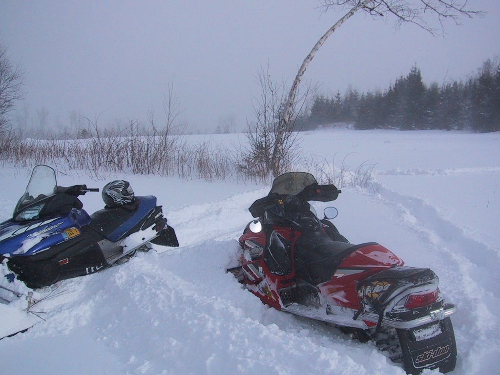
Finally some good news to report. We received 10"-14" of snow yesterday and last night and our trails are now open. Doug and Paul were out with the Piston Bully today, opening gates, clearing blow downs and packing the fresh snow down. Grooming will continue tomorrow and it will take several days to cover the clubs 80+ miles of terrain. Be aware that early season conditions exist, watch out for the groomer, open waterbars, rocks, fallen trees, and other hazards.
These pics were taken earlier today.


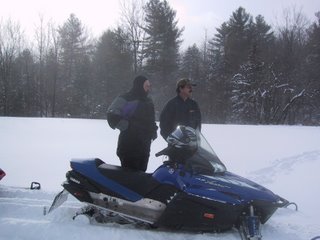

These pics were taken earlier today.


Friday, January 19, 2007
Winter Weather Advisory
We've received 6-8" so far.....
...WINTER WEATHER ADVISORY IN EFFECT UNTIL 7 PM EST SATURDAY...
THE NATIONAL WEATHER SERVICE IN BURLINGTON HAS ISSUED A WINTER WEATHER ADVISORY...WHICH IS IN EFFECT UNTIL 7 PM EST SATURDAY FOR ORLEANS...LAMOILLE AND WASHINGTON COUNTIES...SPECIFICALLY FOR COMMUNITIES CLOSE TO THE GREEN MOUNTAINS.
SNOWFALL ACCUMULATIONS FROM THIS EVENING THROUGH SATURDAY WILL BE 3 TO 7 INCHES WITH LOCALLY HIGHER AMOUNTS POSSIBLE. THE HIGHER AMOUNTS ARE EXPECTED IN COMMUNITIES NEAR THE SPINE OF THE GREEN MOUNTAINS.
SNOW SHOWERS HAVE BEEN PERSISTENT THIS EVENING AND WILL CONTINUE THROUGH SATURDAY. THE MOST PERSISTENT AND HEAVIEST SNOW SHOWER ACTIVITY WILL BE IN THE HIGHER TERRAIN. IN ADDITION TO THE SNOWFALL...NORTHWEST WINDS WILL INCREASE TO 15 TO 25 MPH WITH WIND GUSTS UP TO 40 MPH LATE TONIGHT AND SATURDAY FOR CONSIDERABLE BLOWING OF THE SNOW.
...WINTER WEATHER ADVISORY IN EFFECT UNTIL 7 PM EST SATURDAY...
THE NATIONAL WEATHER SERVICE IN BURLINGTON HAS ISSUED A WINTER WEATHER ADVISORY...WHICH IS IN EFFECT UNTIL 7 PM EST SATURDAY FOR ORLEANS...LAMOILLE AND WASHINGTON COUNTIES...SPECIFICALLY FOR COMMUNITIES CLOSE TO THE GREEN MOUNTAINS.
SNOWFALL ACCUMULATIONS FROM THIS EVENING THROUGH SATURDAY WILL BE 3 TO 7 INCHES WITH LOCALLY HIGHER AMOUNTS POSSIBLE. THE HIGHER AMOUNTS ARE EXPECTED IN COMMUNITIES NEAR THE SPINE OF THE GREEN MOUNTAINS.
SNOW SHOWERS HAVE BEEN PERSISTENT THIS EVENING AND WILL CONTINUE THROUGH SATURDAY. THE MOST PERSISTENT AND HEAVIEST SNOW SHOWER ACTIVITY WILL BE IN THE HIGHER TERRAIN. IN ADDITION TO THE SNOWFALL...NORTHWEST WINDS WILL INCREASE TO 15 TO 25 MPH WITH WIND GUSTS UP TO 40 MPH LATE TONIGHT AND SATURDAY FOR CONSIDERABLE BLOWING OF THE SNOW.
Wednesday, January 17, 2007
Special Weather Statement
Keep your fingers crossed........
SPECIAL WEATHER STATEMENT
NATIONAL WEATHER SERVICE BURLINGTON VT
345 PM EST WED JAN 17 2007
...PERIODS OF SNOW AND SNOW SHOWERS FRIDAY THROUGH SATURDAY ACROSS CENTRAL AND NORTHERN VERMONT WITH WINDY CONDITIONS POSSIBLE SATURDAY...
A WEAK UPPER LEVEL DISTURBANCE MOVING IN FROM THE WEST WILL BRING A GENERAL 1 TO 3 INCHES OF SNOW TO MOST OF VERMONT ON FRIDAY. MEANWHILE...A COASTAL LOW WILL STRENGTHEN IN THE GULF OF MAINE FRIDAY AFTERNOON AND TRACK NORTHWARD INTO NEW BRUNSWICK BY SATURDAY. ALTHOUGH THE BULK OF PRECIPITATION WITH THE COASTAL LOW IS EXPECTED TO REMAIN EAST OF THE AREA...WRAP AROUND MOISTURE FROM THIS SYSTEM WILL RESULT IN PERIODS OF SNOW SHOWERS FRIDAY NIGHT THROUGH SATURDAY AS THE LOW STALLS TO OUR NORTHEAST. ADDITIONAL SNOW ACCUMULATIONS ARE EXPECTED FRIDAY NIGHT AND SATURDAY...WITH THE GREATEST POTENTIAL ACCUMULATION IN THE MOUNTAINS OF NORTHERN VERMONT. SOME ADDITIONAL LIGHT ACCUMULATION IS ALSO POSSIBLE IN THE VALLEYS.
STRONG NORTH WINDS MAY ACCOMPANY THE SNOW SHOWERS LATE FRIDAY NIGHT INTO SATURDAY. MAGNITUDE OF WINDS ON SATURDAY WILL DEPEND ON HOW STRONG THE LOW PRESSURE AREA BECOMES TO OUR NORTHEAST ON SATURDAY. CURRENT INDICATIONS SUGGEST GUSTS TO 40 MPH ARE POSSIBLE.
SPECIAL WEATHER STATEMENT
NATIONAL WEATHER SERVICE BURLINGTON VT
345 PM EST WED JAN 17 2007
...PERIODS OF SNOW AND SNOW SHOWERS FRIDAY THROUGH SATURDAY ACROSS CENTRAL AND NORTHERN VERMONT WITH WINDY CONDITIONS POSSIBLE SATURDAY...
A WEAK UPPER LEVEL DISTURBANCE MOVING IN FROM THE WEST WILL BRING A GENERAL 1 TO 3 INCHES OF SNOW TO MOST OF VERMONT ON FRIDAY. MEANWHILE...A COASTAL LOW WILL STRENGTHEN IN THE GULF OF MAINE FRIDAY AFTERNOON AND TRACK NORTHWARD INTO NEW BRUNSWICK BY SATURDAY. ALTHOUGH THE BULK OF PRECIPITATION WITH THE COASTAL LOW IS EXPECTED TO REMAIN EAST OF THE AREA...WRAP AROUND MOISTURE FROM THIS SYSTEM WILL RESULT IN PERIODS OF SNOW SHOWERS FRIDAY NIGHT THROUGH SATURDAY AS THE LOW STALLS TO OUR NORTHEAST. ADDITIONAL SNOW ACCUMULATIONS ARE EXPECTED FRIDAY NIGHT AND SATURDAY...WITH THE GREATEST POTENTIAL ACCUMULATION IN THE MOUNTAINS OF NORTHERN VERMONT. SOME ADDITIONAL LIGHT ACCUMULATION IS ALSO POSSIBLE IN THE VALLEYS.
STRONG NORTH WINDS MAY ACCOMPANY THE SNOW SHOWERS LATE FRIDAY NIGHT INTO SATURDAY. MAGNITUDE OF WINDS ON SATURDAY WILL DEPEND ON HOW STRONG THE LOW PRESSURE AREA BECOMES TO OUR NORTHEAST ON SATURDAY. CURRENT INDICATIONS SUGGEST GUSTS TO 40 MPH ARE POSSIBLE.
Tuesday, January 16, 2007
Busted Storm
The following article appeared recently in the Burlington Free Press and was picked up by the Associated Press. It is important that all those who enjoy our trail system purchase their TMA's soon and show their support for the sport.
Busted storm another bad omen for snowmobile industry
By Wilson Ring
The Associated Press
MONTPELIER — Today's snowstorm that fizzled into a mess of sleet and freezing rain pushed Vermont’s snowmobile industry one step closer to turning the season into a complete washout.
Almost a month after the state’s 4,600-mile snowmobile system usually opens for the season, only one 30 mile stretch of trail — between Jay and Richford — was open, said Bryan Watson, the executive director of the Vermont Association of Snow Travelers.
“I have been a snowmobiler since 1965. This is by far the worst season I can remember,” said Watts. “To have this be the way that it is throughout the entire state is pretty much unseen.”
Watson said snowmobile trails needed a compacted base of about six inches of snow before they could be opened. The best case is for there to be a series of six-inch to eight-inch snowstorms that drop at least 18 to 24 inches.
To break even for the year VAST needs to sell about 30,000 trail passes. As of last week the organization had sold 4,855, Watson said.
There’s a similar story in New Hampshire.
“The first quarter of the snowmobile season was a huge loss,” said Craig Mayo, president of the New Hampshire Snowmobile Association.
On an average year, snowmobiling pumps about $550 million into the Vermont economy. Tens of thousands of snowmobilers spend money at convenience stores along the trails, restaurants, hotels and motels and for the equipment itself.
This winter is lining up to be the third consecutive tough season for the snowmobile industry. Watson has said it could push about half the state’s snowmobile dealers out of business.
While the weather forecast for the rest of the week calls for colder weather, there are no significant storms predicted through the end of the month. “It doesn’t look like there is anything in the cards,” Watson said.
The colder weather will help, though, if snow follows. Watson said that in much of the state the ground has been so wet that it would take several feet of snow before it could be compacted enough to open the trails. Once the ground freezes, it would be ready for the snow.
But even if abundant snow falls during the second half of the winter it might be too late.
“There comes a point when snowmobilers will just say ’to hell with it,’” Watson said. “We’re coming very close to that point right now.”
Vermont’s alpine ski areas are able to salvage the season with their extensive — and expensive — snowmaking operations. There is no snowmaking on snowmobile trails.
Vermont’s snowmobile trail system usually closes for the season some time in April.
Busted storm another bad omen for snowmobile industry
By Wilson Ring
The Associated Press
MONTPELIER — Today's snowstorm that fizzled into a mess of sleet and freezing rain pushed Vermont’s snowmobile industry one step closer to turning the season into a complete washout.
Almost a month after the state’s 4,600-mile snowmobile system usually opens for the season, only one 30 mile stretch of trail — between Jay and Richford — was open, said Bryan Watson, the executive director of the Vermont Association of Snow Travelers.
“I have been a snowmobiler since 1965. This is by far the worst season I can remember,” said Watts. “To have this be the way that it is throughout the entire state is pretty much unseen.”
Watson said snowmobile trails needed a compacted base of about six inches of snow before they could be opened. The best case is for there to be a series of six-inch to eight-inch snowstorms that drop at least 18 to 24 inches.
To break even for the year VAST needs to sell about 30,000 trail passes. As of last week the organization had sold 4,855, Watson said.
There’s a similar story in New Hampshire.
“The first quarter of the snowmobile season was a huge loss,” said Craig Mayo, president of the New Hampshire Snowmobile Association.
On an average year, snowmobiling pumps about $550 million into the Vermont economy. Tens of thousands of snowmobilers spend money at convenience stores along the trails, restaurants, hotels and motels and for the equipment itself.
This winter is lining up to be the third consecutive tough season for the snowmobile industry. Watson has said it could push about half the state’s snowmobile dealers out of business.
While the weather forecast for the rest of the week calls for colder weather, there are no significant storms predicted through the end of the month. “It doesn’t look like there is anything in the cards,” Watson said.
The colder weather will help, though, if snow follows. Watson said that in much of the state the ground has been so wet that it would take several feet of snow before it could be compacted enough to open the trails. Once the ground freezes, it would be ready for the snow.
But even if abundant snow falls during the second half of the winter it might be too late.
“There comes a point when snowmobilers will just say ’to hell with it,’” Watson said. “We’re coming very close to that point right now.”
Vermont’s alpine ski areas are able to salvage the season with their extensive — and expensive — snowmaking operations. There is no snowmaking on snowmobile trails.
Vermont’s snowmobile trail system usually closes for the season some time in April.
Sunday, January 14, 2007
Winter Storm Warning
Winter Storm Warning
URGENT - WINTER WEATHER MESSAGE
NATIONAL WEATHER SERVICE BURLINGTON VT
424 AM EST SUN JAN 14 2007
...SIGNIFICANT SNOWFALL POSSIBLE ACROSS THE NORTH COUNTRY LATE SUNDAY NIGHT INTO TUESDAY MORNING...
.A STALLED FRONTAL SYSTEM ACROSS THE NORTHEAST WILL BE THE FOCUS FOR SNOWFALL ACROSS THE NORTH COUNTRY FROM TODAY INTO TUESDAY MORNING. TWO AREAS OF LOW PRESSURE WILL MOVE EAST ALONG THIS FRONT...THE FIRST COMING TODAY...AND THE SECOND DURING THE DAY ON MONDAY.
TODAY...A WEAK AREA OF LOW PRESSURE WILL TRACK EAST THROUGH CENTRAL PENNSYLVANIA...RESULTING IN LIGHT SNOW ACROSS NORTHERN NEW YORK AND VERMONT. SNOWFALL AMOUNTS WILL GENERALLY BE LIGHT...WITH A DUSTING TO 2 INCHES OF ACCUMULATION EXPECTED.
THEREAFTER...A MUCH STRONGER LOW PRESSURE SYSTEM WILL DEVELOP IN THE OHIO VALLEY...AND MOVE EAST ALONG THE STALLED FRONT ON MONDAY. NORTH OF THE FRONT TEMPERATURES WILL BE COLD ENOUGH TO
SUPPORT ALL SNOW. MEANWHILE...SOUTH OF THE FRONT...SPECIFICALLY IN CENTRAL AND SOUTHERN VERMONT...TEMPERATURES ALOFT WILL BE WARM ENOUGH TO CAUSE A MIX OF SNOW AND SLEET DURING THE DAY ON
MONDAY...BEFORE CHANGING OVER TO ALL SNOW MONDAY NIGHT. THE POTENTIAL EXISTS FOR MORE THAN 6 INCHES OF SNOWFALL WITH THIS SYSTEM.
URGENT - WINTER WEATHER MESSAGE
NATIONAL WEATHER SERVICE BURLINGTON VT
424 AM EST SUN JAN 14 2007
...SIGNIFICANT SNOWFALL POSSIBLE ACROSS THE NORTH COUNTRY LATE SUNDAY NIGHT INTO TUESDAY MORNING...
.A STALLED FRONTAL SYSTEM ACROSS THE NORTHEAST WILL BE THE FOCUS FOR SNOWFALL ACROSS THE NORTH COUNTRY FROM TODAY INTO TUESDAY MORNING. TWO AREAS OF LOW PRESSURE WILL MOVE EAST ALONG THIS FRONT...THE FIRST COMING TODAY...AND THE SECOND DURING THE DAY ON MONDAY.
TODAY...A WEAK AREA OF LOW PRESSURE WILL TRACK EAST THROUGH CENTRAL PENNSYLVANIA...RESULTING IN LIGHT SNOW ACROSS NORTHERN NEW YORK AND VERMONT. SNOWFALL AMOUNTS WILL GENERALLY BE LIGHT...WITH A DUSTING TO 2 INCHES OF ACCUMULATION EXPECTED.
THEREAFTER...A MUCH STRONGER LOW PRESSURE SYSTEM WILL DEVELOP IN THE OHIO VALLEY...AND MOVE EAST ALONG THE STALLED FRONT ON MONDAY. NORTH OF THE FRONT TEMPERATURES WILL BE COLD ENOUGH TO
SUPPORT ALL SNOW. MEANWHILE...SOUTH OF THE FRONT...SPECIFICALLY IN CENTRAL AND SOUTHERN VERMONT...TEMPERATURES ALOFT WILL BE WARM ENOUGH TO CAUSE A MIX OF SNOW AND SLEET DURING THE DAY ON
MONDAY...BEFORE CHANGING OVER TO ALL SNOW MONDAY NIGHT. THE POTENTIAL EXISTS FOR MORE THAN 6 INCHES OF SNOWFALL WITH THIS SYSTEM.
Saturday, January 13, 2007
Winter Storm Watch
Finally some good news for the Ridge Runners....
Winter Storm Watch
URGENT - WINTER WEATHER MESSAGE
NATIONAL WEATHER SERVICE BURLINGTON VT
238 PM EST SAT JAN 13 2007
...SIGNIFICANT SNOWFALL POSSIBLE ACROSS THE NORTH COUNTRY LATE SUNDAY NIGHT INTO TUESDAY MORNING...
A STALLED COLD FRONT ACROSS THE NORTHEAST WILL BE THE FOCUS FOR SNOWFALL ACROSS THE NORTH COUNTRY FROM SUNDAY INTO TUESDAY MORNING.TWO AREAS OF LOW PRESSURE WILL MOVE EAST ALONG THIS FRONT...THE FIRST COMING DURING THE DAY ON SUNDAY...THE OTHER DURING THE DAY ON MONDAY.
ON SUNDAY...A WEAK AREA OF LOW PRESSURE WILL TRACK EAST THROUGH CENTRAL PENNSYLVANIA...RESULTING IN LIGHT SNOW ACROSS NORTHERN NEW YORK AND VERMONT. SNOWFALL AMOUNTS WILL GENERALLY BE LIGHT...WITH 1 TO 3 INCHES OF ACCUMULATION EXPECTED.
THEREAFTER...A MUCH STRONGER LOW PRESSURE SYSTEM WILL DEVELOP IN THE OHIO VALLEY...AND MOVE EAST ALONG THE STALLED FRONT ON MONDAY. NORTH OF THE FRONT TEMPERATURES WILL BE COLD ENOUGH TO SUPPORT ALL SNOW.
MEANWHILE...SOUTH OF THE FRONT...SPECIFICALLY IN CENTRAL AND SOUTHERN VERMONT...TEMPERATURES ALOFT WILL BE WARM ENOUGH TO CAUSE A MIX OF SNOW AND SLEET DURING THE DAY ON MONDAY...BEFORE CHANGING OVER TO ALL SNOW MONDAY NIGHT. THE POTENTIAL EXISTS FOR MORE THAN 6 INCHES OF SNOWFALL WITH THIS SYSTEM...ALTHOUGH AT THIS POINT THE EXACT TRACK OF THE LOW AND ASSOCIATED SNOWFALL AMOUNTS ARE STILL
UNCERTAIN.
Winter Storm Watch
URGENT - WINTER WEATHER MESSAGE
NATIONAL WEATHER SERVICE BURLINGTON VT
238 PM EST SAT JAN 13 2007
...SIGNIFICANT SNOWFALL POSSIBLE ACROSS THE NORTH COUNTRY LATE SUNDAY NIGHT INTO TUESDAY MORNING...
A STALLED COLD FRONT ACROSS THE NORTHEAST WILL BE THE FOCUS FOR SNOWFALL ACROSS THE NORTH COUNTRY FROM SUNDAY INTO TUESDAY MORNING.TWO AREAS OF LOW PRESSURE WILL MOVE EAST ALONG THIS FRONT...THE FIRST COMING DURING THE DAY ON SUNDAY...THE OTHER DURING THE DAY ON MONDAY.
ON SUNDAY...A WEAK AREA OF LOW PRESSURE WILL TRACK EAST THROUGH CENTRAL PENNSYLVANIA...RESULTING IN LIGHT SNOW ACROSS NORTHERN NEW YORK AND VERMONT. SNOWFALL AMOUNTS WILL GENERALLY BE LIGHT...WITH 1 TO 3 INCHES OF ACCUMULATION EXPECTED.
THEREAFTER...A MUCH STRONGER LOW PRESSURE SYSTEM WILL DEVELOP IN THE OHIO VALLEY...AND MOVE EAST ALONG THE STALLED FRONT ON MONDAY. NORTH OF THE FRONT TEMPERATURES WILL BE COLD ENOUGH TO SUPPORT ALL SNOW.
MEANWHILE...SOUTH OF THE FRONT...SPECIFICALLY IN CENTRAL AND SOUTHERN VERMONT...TEMPERATURES ALOFT WILL BE WARM ENOUGH TO CAUSE A MIX OF SNOW AND SLEET DURING THE DAY ON MONDAY...BEFORE CHANGING OVER TO ALL SNOW MONDAY NIGHT. THE POTENTIAL EXISTS FOR MORE THAN 6 INCHES OF SNOWFALL WITH THIS SYSTEM...ALTHOUGH AT THIS POINT THE EXACT TRACK OF THE LOW AND ASSOCIATED SNOWFALL AMOUNTS ARE STILL
UNCERTAIN.
Tuesday, January 09, 2007
January 2007 Newsletter
JANUARY NEWSLETTER
President: Art Dages (496-2577)
Vice President: Tony Amenta
Secretary: Cathi Dages
Treasurer: Lois De Heer
Trail Master: Marty De Heer (496-7051)
Ass’t Trail Master: Paul Pizzale (496-4476)
Safety Officer: Skip Wallace (244-1580)
Happy New Year!!!
Trails are closed due to lack of snow. Please check the website for openings. PRAY FOR SNOW !!!
We had our January meeting at the Fayston Town Hall on Tuesday, January 2nd, 2007. Nine members attended. Please join us at the next meeting.
The St. Johnsbury Overnight Ride is scheduled for January 27th and 28th. The trip is subject to weather and trail conditions. Watch the website for updates.
The Canada trip is scheduled for March 2nd and 3rd. Again this trip is subject to weather and trail conditions. Watch the website for updates.
We will be planning our annual February Progressive Dinner. More information next month.
Please contact Tony via emal at vastridgerunner@gmail.com if you have anything to be posted on this site.
Next meeting: February 6th, 7:00 PM at the Fayston Town Hall
President: Art Dages (496-2577)
Vice President: Tony Amenta
Secretary: Cathi Dages
Treasurer: Lois De Heer
Trail Master: Marty De Heer (496-7051)
Ass’t Trail Master: Paul Pizzale (496-4476)
Safety Officer: Skip Wallace (244-1580)
Happy New Year!!!
Trails are closed due to lack of snow. Please check the website for openings. PRAY FOR SNOW !!!
We had our January meeting at the Fayston Town Hall on Tuesday, January 2nd, 2007. Nine members attended. Please join us at the next meeting.
The St. Johnsbury Overnight Ride is scheduled for January 27th and 28th. The trip is subject to weather and trail conditions. Watch the website for updates.
The Canada trip is scheduled for March 2nd and 3rd. Again this trip is subject to weather and trail conditions. Watch the website for updates.
We will be planning our annual February Progressive Dinner. More information next month.
Please contact Tony via emal at vastridgerunner@gmail.com if you have anything to be posted on this site.
Next meeting: February 6th, 7:00 PM at the Fayston Town Hall
Subscribe to:
Posts (Atom)